


Suzanne Oel – Division 4
Greetings! Sharing my News Update…
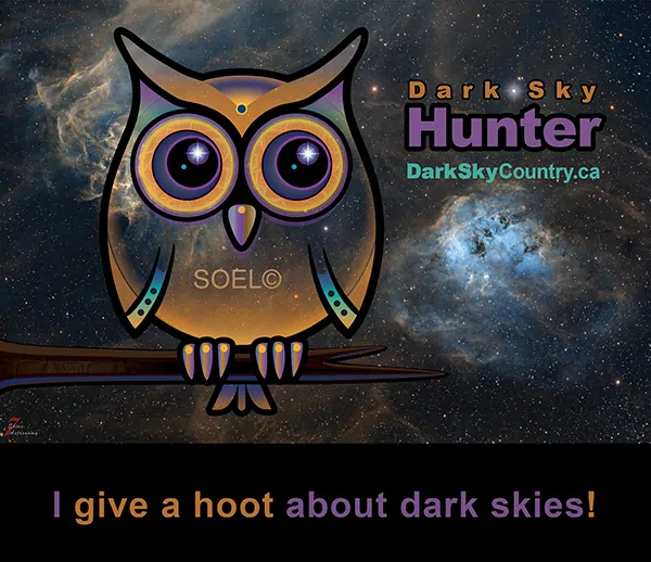
International Dark Sky Week: Celebrate the wonderous night sky April 15-22, 2023! Take a moment to look up at the stars and enjoy the view. Learn more about IDA’s “Discover the Night”: idsw.darksky.org/
Locally, since 2009, Foothills County has partnered with the Rothney Astrophysical Observatory, Cross Conservation Area, Royal Astronomical Society of Canada and interested residents on supporting our Dark Sky Initiative. Thanks to all our members who volunteer their time and talents!
Our GOALS are to create awareness about Dark Skies, in a friendly manner, and lead people to be curious to “look up” and find information about preserving Dark Skies, participate in reducing light pollution and consider using exterior lighting that makes sense such as motion sensor lighting. We’ll also be hosting several Dark Sky and Star- related events throughout 2023.
With all these efforts, we hope to help mitigate the effects of light pollution on natural biological processes, human and animal health, our connected landscapes, viewing the stars as part as the enjoyment of country living, and preserving the functioning of this world-class Observatory and the Cross Conservation Nocturnal Preserve.
We continue to post our DARK SKY COUNTRY signs in the County. We assist Interested neighbourhoods, who can contact us to arrange this. Our next collaborative project will be rolling out very soon. I hope to share more information with you in my the next HCN article.
You can help too! By learning about Dark Skies… Changing a light fixture… And, sharing with a friend. Visit: DarkSkyCountry.ca
Flood Mapping Resources: Whether you are considering a building project near water or looking at purchasing a piece of property, flood prediction mapping is a helpful resource to include in your research. Foothills County provides a flood overlay on our mapping to assist with identifying potential risk on properties. You can access information by contacting our GIS department. Let me know if you want to know more about this.
Additionally, this provincial website provides detailed information about flood potential on many creeks and rivers throughout Alberta and for some within Foothills County: floods.alberta.ca/
The creation of this mapping has taken place over many years. As a result of ongoing work, plus additional investigations and modeling after 2013 flooding, we now have a few types of maps to learn from. You can explore the “Hazard” maps defining the floodway and flood fringe areas, “Inundation” maps showing areas at risk for different sizes of floods, “Likelihood” maps which illustrate cumulative flood risk over 30 years, and “Range” maps comparing two different sizes of floods.
On the “floods.alberta.ca” home page, you will also see a button-link that leads you to view the more extensive “Draft” flood inundation maps, from new studies, that are in the stage of being finalized. Three of these draft maps are situated in Foothills County, including the Priddis River Hazard Study (includes Priddis & Fish Creeks), the Sheep
River Hazard Study and the Highwood River Hazard Study. The website states that these flood inundation maps show areas at risk for different-sized floods, including ice jam floods in some communities. These maps also identify areas that could be flooded if local berms fail, and are typically used for emergency response planning and to inform local infrastructure design.
Alberta Water Well Database: If you are interested in doing some homework regarding groundwater on your own property or other areas within the County or Province, you can find a lot of groundwater well records through the Alberta Water Well Information Database website, which hosts a database of approximately 500,000 records with some 3,000 new records added each year. Shared public information includes water well drilling reports, chemical analysis reports up to the end of 1986, geophysical logs, springs, flowing shot holes, test holes and yield tests conducted on water wells. Data is submitted to the Groundwater Information Centre through the Water Well Drilling Report Submission System. You can view and print individual well records, overlaying map(s) that show individual well records in relation to other wells, roads and other physical features. The entire database can also be downloaded using the “data” tab found on the website. For directions on how to use this database, click the “introduction” tab on the top right-side. All this information can be found here: groundwater.alberta.ca/waterwells/d/
Volunteers Needed: Hope you are able to take part in our local events throughout the year! Congrats to all Community Associations and their volunteers for making these fun events happen. Please consider joining with the teams in our community to make a difference and to add your valuable perspective and a helping hand. Let me know if you are interested and I can refer you to a local organization or county committee in need.
For Other News & Updates:
Facebook: www.facebook.com/CouncillorSuzanneOel/
Email: Suzanne.Oel@FoothillsCountyAB.ca
With best regards,
Suzanne


 Free Classifieds